


Mt. Fuji & Sabo Project
Front Page>
Mt. Fuji & Sabo Project >
History >
History of Disasters
History of Disasters
Collapsed sediment streams from the southwest at the foot of the mountain stream, like Osawa failure, has often hit the lower areas of debris flows through the river channels diried ordinaly in the snowmelt season and heavy rain seasons.
These streams would often spread themselves, damaging rice and crop fields, and streams with flood toward lower areas again. Those residents that lived along the river have often suffered from many disasters by these chains of sediment streams. With that, it has caused the riverbed to rise at the Urui River and bring the large deposit problem of sediment to Tagonoura Port.
The debris flow at Mt. Fuji would occur during typhoon seasons, rainy seasons, and also during the snow-melting season of early winter and late spring. This is a characteristic point of Mt. Fuji.
History of disasters
Click  and show details of the disaster
and show details of the disaster
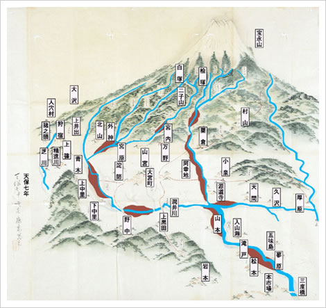
Snowmelt flooding disaster in 1835
|
|
||||||||||||
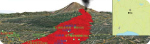
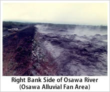
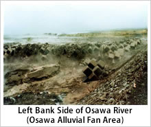
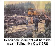
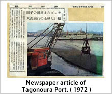
disaster in 1972
|
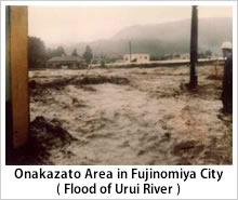
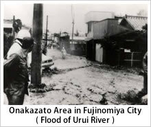
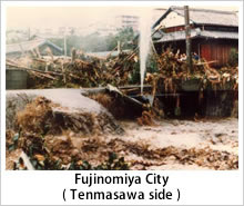
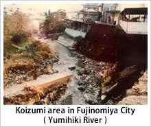
In 1972, there was a rainfall of more than 300mm both on May 1st and May 5th.
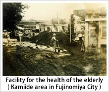
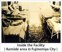
Additionally, the abnormal weather caused the melting of snow and the avalanche from the peak, and an extraordinary amount of debris flow from the peak flow down. The debris flow spreaded to alluvial fan areas and the mudflow reached Tagonoura Port through Urui River. A large amount of sediment carried the port by rushing streams and deposits. On June 8th and July 12th, the debris flow damaged some rivers, roads, bridges, water pipes, and diversion weirs. On July 12th, the Urui River flooded. The silt or gravel rushed into Shiraitoryo, a facility for the health of the elderly, but the people who stayed there evacuated safely. |
|||||||||
| ※Click the picture and enlarge in new window | |||||||||
|
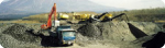
Disaster in 1979
※Click the picture and enlarge in new window
|
||||||||
|
||||||||