


Mt. Fuji & Sabo Project
Front Page>
Mt. Fuji & Sabo Project >
Project Overview
Project Overview
About 70% of the land in Japan has been formed by mountains. It belongs to the Ring of Fire and its land is a part of the Asian monsoon region. Therefore, people's lives have been threatened by variety of disasters, volcanic eruptions, earthquakes, debris flow caused by heavy rain, landslide, and collapse of cliff. The action to prevent those disasters are called "SABO", in Japan.
Mt. Fuji Sabo Office promotes 2 projects on disaster prevention.
1. Prevention of sediment-related disasters:
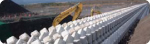
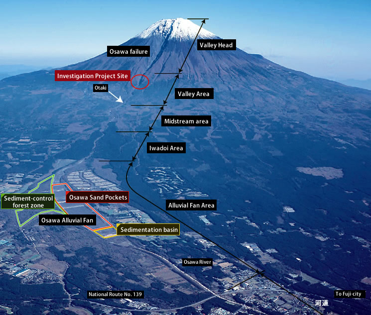
Measures for the Osawa alluvial fan and measures for torrents at the southwest base of the mountain.
2. Volcanic Sabo investigation:
Investigation for the prevention of sediment-related disasters are caused by volcanic activities of Mt. Fuji.
Mt. Fuji Sabo Office promotes 2 projects on disaster prevention.
1. Prevention of sediment-related disasters:
Measures for the Osawa alluvial fan and measures for torrents at the southwest base of the mountain.
2. Volcanic Sabo investigation:
Investigation for the prevention of sediment-related disasters are caused by volcanic activities of Mt. Fuji.
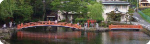
What is a Sabo?
About the root of a word "Sabo" and Sabo facilities, we explain it here.
What is a SABO?
What is a SABO?
Sabo projects to prevent from sediment-related disasters
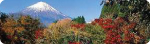
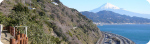
Mt. Fuji, the highest mountain in Japan, has an appearance so beautiful that it symbolizes for our country.
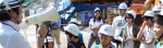
At the southwest foothills of Mt. Fuji, there are main artery transportations including the Tokaido Line and the Tomei Highway. Many people from around the world visit here to see Japan's leading tourist destination, Mt. Fuji. Large-scale projects are also underway like the Second Tomei Expressway for example, so it has become an important area. The Fuji Sabo Office observes the Mt. Fuji southwest area and develops sediment-related disaster prevention measures.
At the southwest foothills of Mt. Fuji, there are main artery transportations including the Tokaido Line and the Tomei Highway. Many people from around the world visit here to see Japan's leading tourist destination, Mt. Fuji. Large-scale projects are also underway like the Second Tomei Expressway for example, so it has become an important area. The Fuji Sabo Office observes the Mt. Fuji southwest area and develops sediment-related disaster prevention measures.
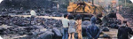
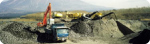
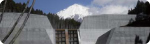
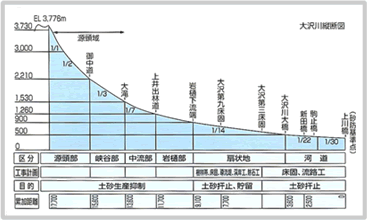
Measures for Osawa alluvial fan
|
||||
 |
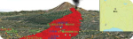
Volcanic Sabo Investigation
Mt. Fuji is an active volcano that has erupted regularly from the beginning of recorded history; it has been erupting for more than 10,000 years since the formation.
Since the Hoei eruption of 1707, it has remained quiet for about 300 years. It has been predicted that enormous disasters occurs by its eruption.
The low-frequency earthquakes that occurred in the underground of Mt. Fuji in 2000 gave attention to the experts, and the volcanic disaster prevention measures for Mt.Fuji started to be researched in earnest.
In June 2004, the Review Committee for Mt. Fuji Volcanic Hazard Map published the "Mt. Fuji Volcano hazard map", and the peripheral municipalities of Mt. Fuji have begun activities for disaster prevention measures.
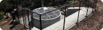
The Fuji Sabo Office has engaged in the investigation for the prevention of sediment-related disasters caused by volcanic activities of Mt. Fuji.
Investigations and activities include:
Investigation of Fuji Volcanic Sabo plans (Sabo facility placement plans)
Development of observation system
Cooperation with related organizations
Planning the scheme of real-time hazard map
In June 2004, the Review Committee for Mt. Fuji Volcanic Hazard Map published the "Mt. Fuji Volcano hazard map", and the peripheral municipalities of Mt. Fuji have begun activities for disaster prevention measures.
The Fuji Sabo Office has engaged in the investigation for the prevention of sediment-related disasters caused by volcanic activities of Mt. Fuji.
Investigations and activities include:
Investigation of Fuji Volcanic Sabo plans (Sabo facility placement plans)
Development of observation system
Cooperation with related organizations
Planning the scheme of real-time hazard map