


Mt. Fuji & Sabo Project
Front Page>
Mt. Fuji & Sabo Project >
Further Study >
Lava Flow 3 Dimensional Map & Simulation
Lava Flow 3 Dimensional Map & Simulation
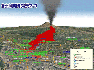 |
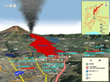
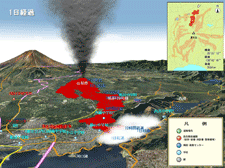
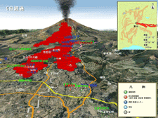
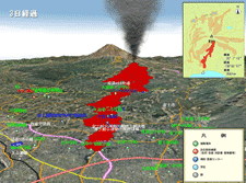
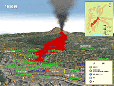
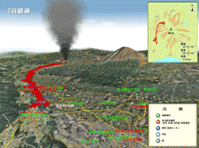
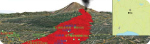
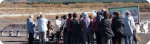
Mt. Fuji Sabo office has created the "Mt. Fuji lava flow three-dimensional map" to easily find out about the reach range of lava flowed. This helps the visitors and residents for deeper understanding about volcano disaster prevention.
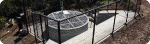
'Lava flow three-dimensional map' can be stereoscopic and video displayed at any point of view, so we can recognise more easy about a situation in which way the lava flew out. There are 2 point to focus on: 1. Information about the movement of how the flow with the lapse of time2. Understanding the positional relationship of familiar areas and the expected damage range |
From the movie links below, you can see the simulated flows of lava as samples extracted from the "Mt. Fuji lava flow three-dimensional map". (Fixed viewpoint movies)
|