


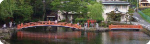


Mt. Fuji & Sabo Project
Innovation
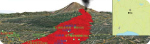
Active Volcano, Mt. Fuji
 |
|
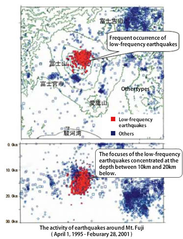
Low-frequency earthquakes in the underground of Mt. Fuji occurred frequently. (October- December 2000) |
|
|
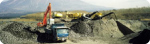
The Current State of the Osawa Failure
The Osawa failure has been producing a large amount of debris and brought debris flow. We report the current state of the Osawa failure and its colluption mechanisms.
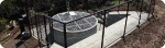
Observation System
To monitor the activities of debris flowings of the Osawa River and torrrents, we have developed, installed and maintained many surveillance cameras and sensors.
Technology Development
In order to carry out the projects in safe and in consideration of the environment, we developed unmanned construction machineries and promoted the operation with unmanned construction by helicopters.
Volcanic Sabo Investigation
To prevent disasters and to protect the landscape, we have been exploring possibly feasible schemes, enforcing various surveys and testing projects.
Lava Flow 3 Dimensional Map & Simulation
Mt. Fuji Sabo office has created the "Mt. Fuji lava flow three-dimensional map" for easier find out about the reach range of lava flowed. This also helps the visitors and residents for deeper understanding about volcano disaster prevention.