


What kinds of works does Fuji Sabo Office do?
Protecting Lives from Disasters
Project effectiveness
Information infrastructure development
To protect the area from debris flows that occur in the Osawa River and the Southwestern valleys, rain gauges, mountain stream surveillance cameras, wire sensors, etc. are install to monitor real-time situations.
We are also considering construction of a volcano surveillance system using CCTV cameras as a measure against volcano disasters.
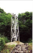 【CCTV Camera】 |
These are installed to monitor debris flows in mountain streams as well as Mt. Fuji volcano. Field images are delivered by optical cables, making real-time monitoring possible at offices, etc.
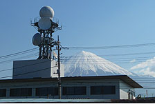 【Fuji Sabo Radar Rain Gauge】 |
The Chubu Regional Development Bureau has installed X-band MP radars at three locations in Shizuoka Prefecture, enabling detailed and real-time rainfall observations.
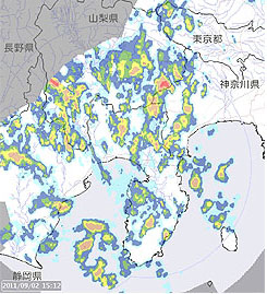 【X-band MP radar rainfall information (Shizuoka)】 |
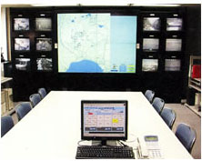 【Disaster Countermeasures Office】 |
All information collected from camera images, rainfall and water level information, weather information, etc. are stored here. It plays a pivotal role in managing a Disaster System.
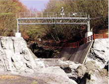 【Debris flow observation bridge at Iwadoi downstream】 |
When a debris flow occurs, water level and flow rate of the debris flow can be measured from here.
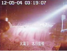 【Debris flow on December 5, 2004 (Otaki CCTV camera)】 |
The next page explains the volcano observation system.